3D relief map
Machined in foam using CAD data.
We are able supply to data & mill maps of The United Kingdom & Northern Ireland.
We can also make maps from your data.
Please call for details.

Relief map of the CairnGorm mountains machined in PU model block.
Machinable surface created from Ordnance Survey data.
We can advise and assist in getting the correct data from Ordnance Survey.
Aveimore in the top left of the map.
The area covered is approx 35 kilometres x 25 kilometres.
Map size 1100mm x 800mm rise and fall approx 70mm plus base.

North west corner of the CairnGorm mountain range.

CairnGorm relief map, central southern area.

3D map machined in solid oak about 700mm x 600mm.

The height extruded to to exaggerate the contours.

Hand finished by the client.

The Chilterns
10 foam tiles 1100mm x 1100mm x 250mm in size creating a 5.5 metre x 2.2 metre model of a 5 x 2 kilometre area of the Chilterns.

This 3d raised relief map has been scaled up in the height to give a better feel to the contours.
The blocks are approx 250mm (10 inches) thick, the longest reach on a router cutter we have is 150mm, hence the unmachined area on the sides.
It's possible to have a longer custom made, this would take 3 weeks and only be suitable for light materials only.

The bottom of the picture is north.
A tactile relief map of part of Dorset that has been made for the Dorset wildlife Trust as part of the visiting centre.
Eggardon Hill fort is to the top left of the picture. The block is 1350mm x 1175mm x 100mm.
Area approx 8 x 6 Kilometres.
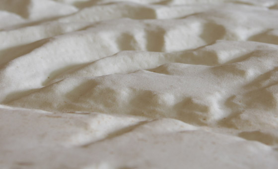
More detail of the Dorset map.